Products

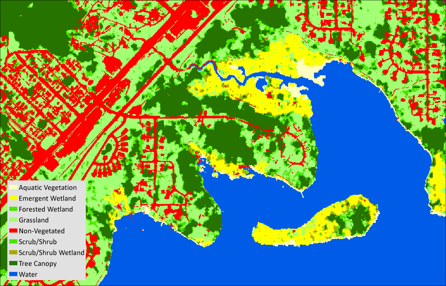
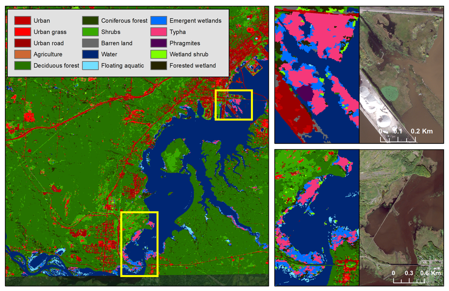
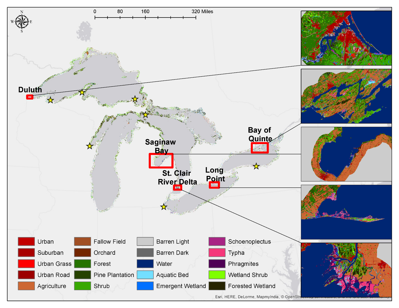
GLARS strives to produce deliverables that are useful to a majority of resource managers and other end users. Manager and end user monitoring needs were determined via surveys early in the project and continued surveying (see the storymap survey tab). Most of the products are focused on the pilot study sites with the exception of the digital surface and elevation models which were produced for every Worldview-2 stereo image pair across the Great Lakes Basin. Other products currently exist only for the 11 pilot Great Lakes coastal wetland sites, including: hydrology products (i.e. surface water extent, wetland inundation extent, water level changes, wetland soil moisture), high-resolution maps of wetland extent, type, and change (gain and loss). The GLARS team worked to build approaches for automated or semi-automated mapping and monitoring and were successful in doing so for most of the products (DSM, hydrology, change products). The exception is the wetland ecotype mapping which requires human input to train the classifiers to produce accurate maps. The team continues to evaluate transfer learning, domain adaptation and other AI approaches to make ecotype mapping more automated.


Explore the products on the interactive GLARS 4D story map .

Download the products at the GLARS Download Hub .

Take a survey to provide feedback on these products.


...
Digital Surface Model (DSM) Products

Commercial satellite imagery was used to develop Digital Surface Models (DSM) and DSM derived products, including mosaics of median values and of variability over time, as resources for other analyses, such as mapping and change detection. Difference DSMs can detect surface change between two dates. Images before and after a wind storm, for example, can be used to detect and measure blowdown in forests.

...
Surface Water Level and Inundation

The intensity and orientation of the returning synthetic aperture radar (SAR) signals in an image convey information about the vegetation and moisture levels on the ground. This allows us to differentiate what regions are water vs. non-water and which areas are flooded vegetation vs. non-flooded vegetation.
High repeat radar sensors, such as RADARSAT-2 used for this effort, that capture imagery on a 24-day cycle allow us to compare changes in inundation and water extent over time. This information can be critical to understanding habitat vulnerabilities, such as the changes in the emergent vegetation nesting grounds of the threatened black tern in St Clair flats.

...
Wetland Type Maps and Wetland Change

Detailed landcover and wetland maps are routinely created and updated at key study areas around the Great Lakes from multi-season optical and radar satellite imagery and digital surface models. These wetland type maps can be used to quantify wetland gain and loss over time.

Optical-IR imagery can be used to identify land cover types using vegetation reflectance which varies depending on features at the cellular level (e.g. chlorophyll, leaf moisture) and background reflectance which depends on surface (e.g., soil type, water). Synthetic aperture radar (SAR) imagery can differentiate wetland types based on inundation/water level patterns, vertical structure, soil moisture and biomass. Digital surface models (DSMs) can identify height of vegetation as well as changes in surface between dates (e.g. measure blowdown in forests).

...
Invasive Species Monitoring

Species level wetland type maps allow Great Lakes managers to track the spread of invasive species such as Phragmites australis and cattail (Typha angustifolia and Typha x glauca). The early detection of invasive species, such as the small patch of Phragmites australis in the St Louis River Estuary depicted in purple in the upper right inset, allows managers to rapidly treat invasions before they spread throughout the wetland complex. Comparing classifications from multiple years allows us to identify the treatment extents and efficacy.