The University of Minnesota’s Remote Sensing and Geospatial Analysis Laboratory (RSGAL) works to advance the development and application of remote sensing and geospatial analysis to inventory and monitor natural resources and environment through research and outreach.
Project Contributions
The University of Minnesota’s Remote Sensing and Geospatial Analysis Laboratory (RSGAL) portion of the project has three specific aims:
Develop an object-based approach for mapping detailed coastal wetlands and landscape features using high resolution satellite imagery and surface models.
Develop a scalable approach for quantifying and monitoring coastal wetland and landscape change.
To distribute the data, methods, and results to users and decision managers.
More Information
Mapping with Surface Models and Satellite Imagery
Wetland mapping for this project ingests high-resolution, stereo satellite imagery, digital surface models (DSMs) and lidar-derived digital elevations models (DEMs) in an object-based image analysis (OBIA) workflow. These methods are implemented in Trimble Geospatial’s eCognition Developer software using the e Cognition Network Language. The OBIA approach integrates the multispectral imagery, DSMs, lidar-derived DEMs, and Great Lakes Coastal Wetland Inventory (GLCWI) data from the Great Lakes Coastal Wetland Consortium.
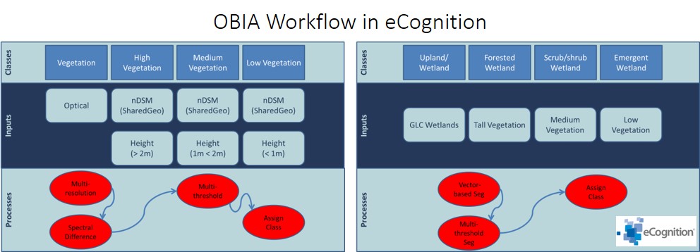
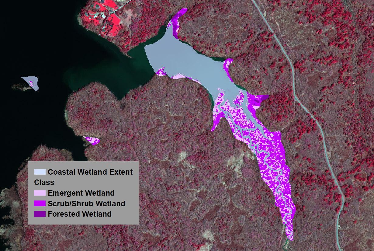
The outputs of this process are the wetland classes: forested, scrub/shrub, and low vegetation within pre-defined wetland polygons (e.g. GLCWI). These are characterized using multiple height thresholds: > 2m, 0.5m < 2m, and < 0.5m. The broader GLCWI polygons are used to aggregate the vegetation classes in the image objects.
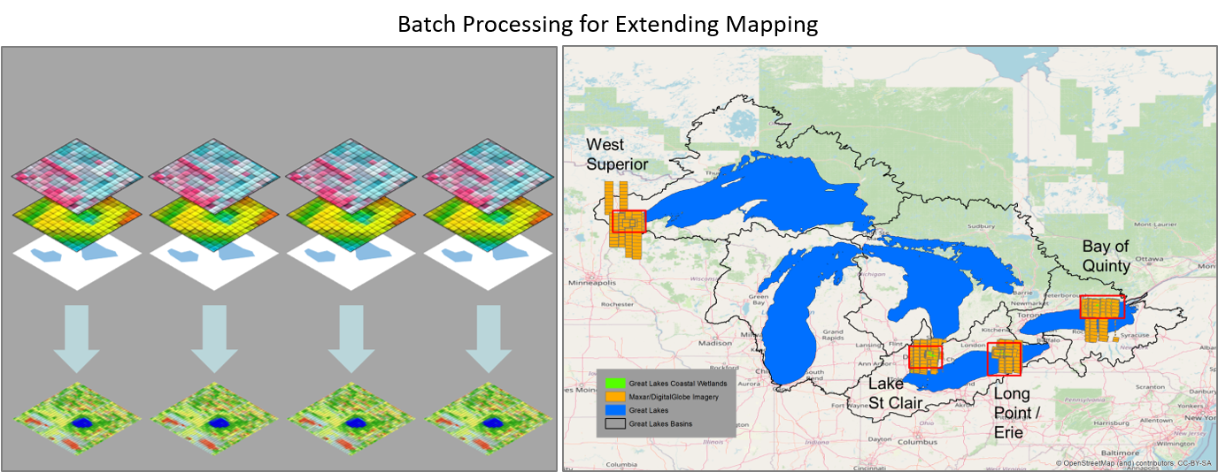
These methods have proven to be robust, scalable, and accurate in the several pilot areas we’ve studied. They can be applied on arbitrary spatial scales using batch processing methods in eCognition. Continuation of the project will allow us to produce wetland maps for the substantial portion of the Great Lakes Basin for which imagery is available.