Partners

Since 2016, the Great Lakes Alliance for Remote Sensing (GLARS) binational team has been building a comprehensive, collaborative and integrated remote sensing program for the Great Lakes System. GLARS partners work to harness the power of high resolution remote sensing to provide vegetation, hydrology, and elevation data products based on the reported needs of wetland managers.

Partners Flowchart

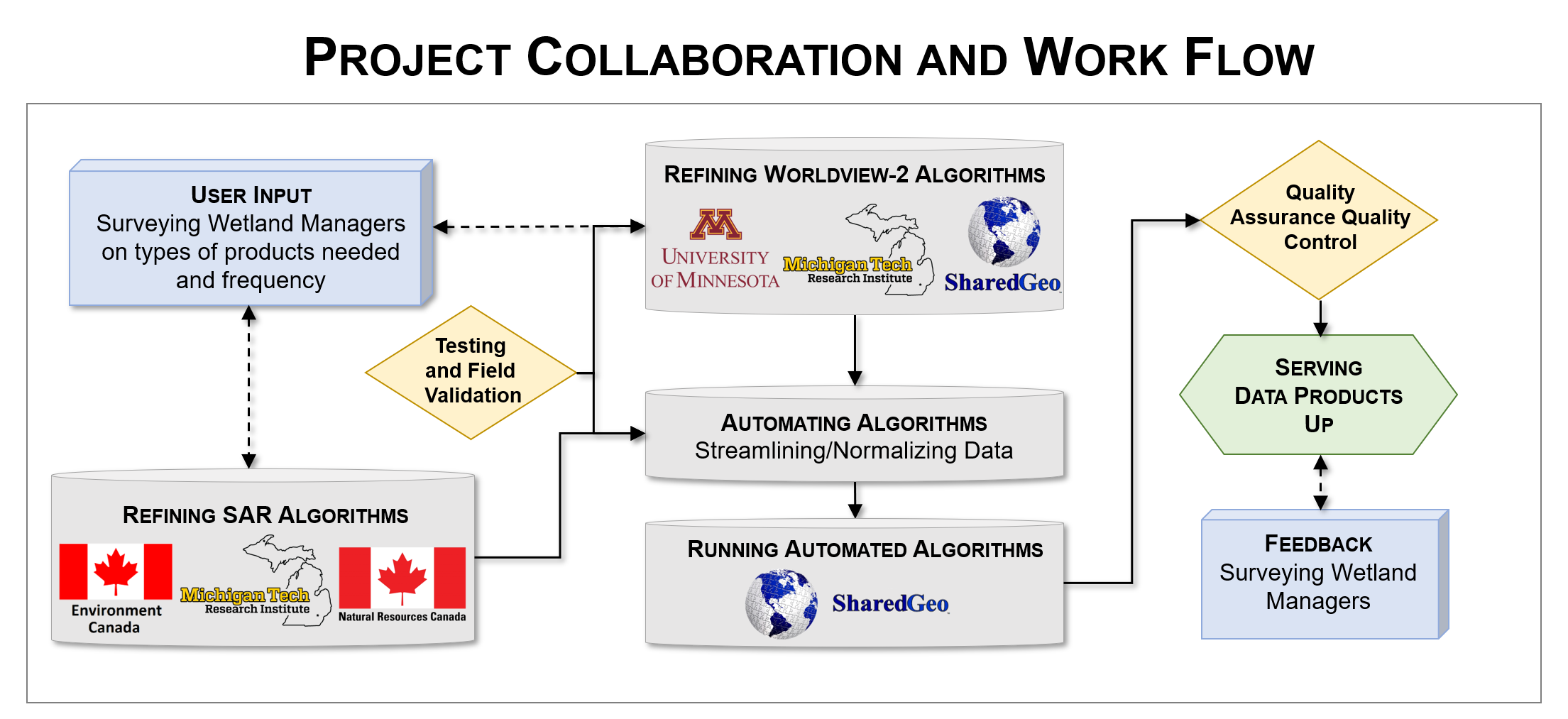
This partnership is sponsored by the Environmental Protection Agency (EPA)*, the US Fish and Wildlife Service (USFWS), and by the Great Lakes Restoration Initiative. For more information on the individual partners check out their individual partnership page.


SharedGeo Logo
SharedGeo, Minnesota

Surface Models
Data Processing
Elevation Change

MTRI Logo
Michigan Tech Research Institute

Coastal Hydrology from SAR
Wetland Change from SAR and Optical
Invasive Species
Wetland Type Mapping

UMN Logo
University of Minnesota

Object-Based Mapping
Scalable Change
Data Distribution

NatResCanada Logo
Canadian Centre for Mapping and Earth Observation, Natural Resources Canada

Refining Synthetic Aperture Radar Algorithms

EnvCanada Logo
National Wildlife Research Centre, Environment and Climate Change Canada

Multi-Temporal Radar Classifications
Model Generation
InSAR wetland water level change

PGC Logo
Polar Geospatial Center

Commercial Satellite Imagery
Mapping Support
Web Applications

*The work was funded by cooperative agreement numbers #F18AC0039 to MTU, #F18AC00038 to UMN, and #F18AC00808 to SharedGeo from the USFWS through the EPA. The research has not been formally reviewed by EPA and the views expressed in this document are solely those of GLARS and do not necessarily reflect those of the Agency. EPA does not endorse any products or commercial services mentioned in this publication.