SharedGeo is a non-profit with a mission to help government, non-profit, educational, and corporate entities share geospatial information for the public good. We do this by providing technical expertise, research, facilities, education, grants, and products. Our specialties include web services and open-source development, U.S. National Grid Implementation and aerial imagery management and services.
Project Contributions
SharedGeo’s role in GLARS is to manage massive volumes of satellite-based input data related to the Great Lakes area watersheds and wildlife habitats. The project uses open-source tools and a variety of computing platforms, including supercomputers, to do the following:
Enhance techniques to produce Digital Surface Models from commercial satellite imagery such that large quantities of frequently-changing imagery can be processed for use in analyses.
Develop and provide various DSM derived output products, including mosaics of median values and of variability over time, to test as inputs to other analyses.
Process other DEM data available (LIDAR) to make basin-wide coordinated products that in can be used in analyses.
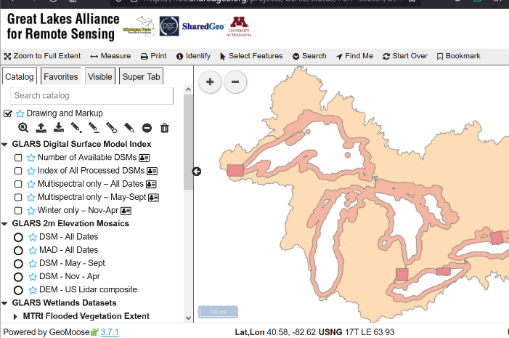
SharedGeo manages product delivery at the GLARS Download Hub.
More Information
Digital Surface Models: Production and Uses
The satellite imagery used for DSM production was collected by Digital Globe (MAXAR) and
made available for Federal partners through the National Geospatial Intelligence Agency under
the NextView contract. Acquisition was managed in cooperation with Polar Geospatial Center.
Digital Surface Models were generated by applying fully automated stereo auto-correlation
techniques to overlapping pairs using SETSM open source software (Noh and Howat, Ohio State Univ.).
Processing was done on the Blue Waters supercomputer (Univ. of Illinois)
Monitoring Change with DSMs
Change detection can be done many ways with DSMs.
Difference DSMs can detect surface change between two dates. Images before and after a wind
storm, for example, can be used to detect and measure blowdown in forests.
Mosaic DSMs combine multiple DSMs to make a seamless reference over a study area. Which individual DSMs
to combine depends on the biological questions being asked. For example, summer and winter DSMs will
have different values for many types of vegetation.
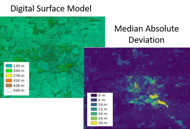
Mosaics are made using the median value of individual pixels, to focus on the robust central tendency
and reduce influence of outliers. Median Absolute Deviation (MAD) at each pixel shows the spread of
values between DSMs collected at different times. Broader spread indicates likelihood of actual change,
rather than image error.
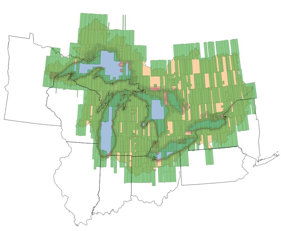
Other DEM data - multi-state Lidar
Available Lidar from states on the US side of the Great Lakes was brought together, standardized, indexed and made usable as base (terrain model) for comparison with DSM products.